 This website is an extension of my book Toronto: Transformations in a City and its Region, published by the University of Pennsylvania Press, 2014 as part of its series of portraits of metropolitan regions of North America.Other books in the series are about Boston, Philadelphia, Portland, San Diego, Phoenix, the Research Triangle, New Jersey, Miami and Detroit.A link to the UPenn announcement for my book, with information about ordering it either in hard cover or as an ebook, is at <http://www.upenn.edu/
If you have comments or questions about the book or this website the best way to contact me is by email at 1944ecr@gmail.com.
As a portrait, or biography, of an urban region my book emphasizes the remarkable changes to urban landscapes that occurred as Toronto grew from a tiny settlement established in 1793 as a British colonial capital, into a polycentric metropolis with a population well over six million.
This website is mostly an extended photo-essay that parallels and elaborates what I wrote about Toronto. Among other things it allows me to share some of the many photos of the urban region that I have taken over the last twenty years. It also provides active links to relevant websites that are cited in my book.
If you wonder who I am and my qualifications for writing about Toronto, there is a short biography at the bottom of the page (and I do discuss this in Chapter 1).
Updates
This “About ‘Toronto Transforms'” page is an introduction to the website and how it works, with a chapter by chapter synopsis that gives a quick overview to help you to skip to sections you find most relevant. The book manuscript I finished in 2013. and most of the web pages were done by early 2014. The posts I date in the title. I have had other things to do for several months so have not updated things for some time, but am now modifying some details, for instance about Priority Neighbourhoods (now calledStrong Neighbourhoods), and transit in the outer suburbs .
A Note on the Mechanics of this Website
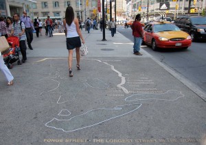
Navigation is usually through the menu at the top since I mostly use a full page width layout. On this page the menu on the right also includes links to posts. The photos pop-up in larger versions if you click on them. Captions to photos are in italics and I often incorporate them into the text because this makes formatting easier. For instance, this photo of an installation embedded in the sidewalk at Dundas Square in downtown shows, among other things, the location of Toronto on the north shore of Lake Ontario, with Yonge Street, the first road built out of the original settlement in 1793 and purportedly the longest street in the world, leading north around the Great Lakes to Rainy River in northern Ontario.
The search bar on the right on this page, as far as I have been able to determine, only identifies illustrations for whatever search term you enter. This might be useful since this website is mostly images – for instance, enter “Markham” and it gives links to all the photos and maps that have Markham in the title.
A Note on Organization
The general organisation of the website (and my book, for that matter) is both historical and geographical – it proceeds from the founding of Toronto as a colonial capital for Upper Canada in 1793 to the current regional plans for the Greater Golden Horseshoe that includes much of south-central Ontario around Toronto, and from the downtown of the old City of Toronto to the metropolitan region that reaches almost from Niagara Falls to Georgian Bay on Lake Huron, and from the automobile assembly city of Oshawa in the east to the hi-tech city of Waterloo in the west. It pays particular attention to recent changes that have occurred as the urban region has extended outwards around the western end of the lake almost to Niagara Falls, and as the heart of the old city has been extensively redeveloped, much of it vertically. In the last half century the personality of the entire urban region has dramatically changed.
I consider the entire built-up area of Toronto, which includes the inner suburbs built mostly under the aegis of Metropolitan Toronto between 1950 and 1970, and the outer suburbs that have been developed since 1970 and are still expanding.
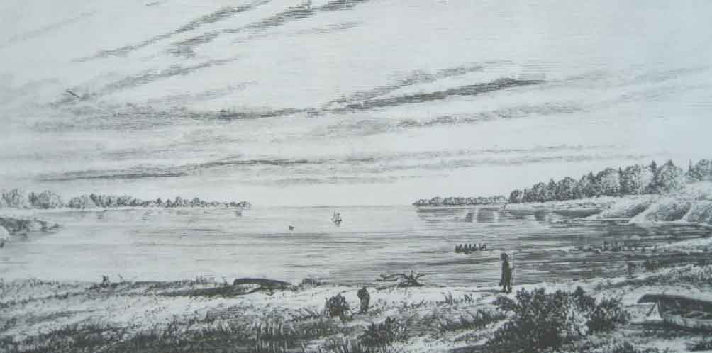
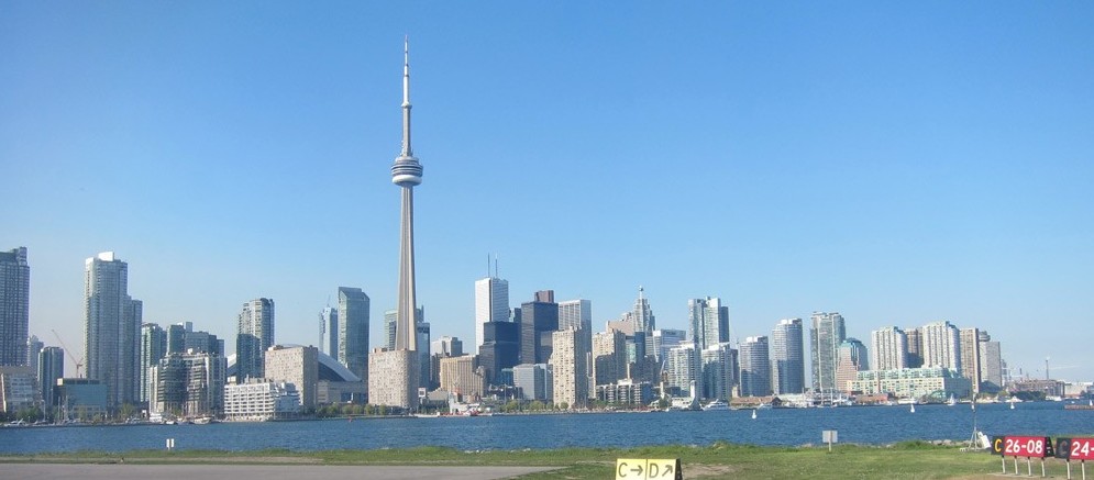
Toronto Harbour in 1793, looking west. The original town site was on the shore to the right. And the Toronto skyline in 2012, looking east; almost nothing you see in this was built before 1970; the original town site is at the far right.
Synopsis of Chapters
An unconventional view of the City of Toronto at its eastern border where 20 lanes of traffic cross the Rouge River, 14 of them in HIghway 401 (the busiest expressway in North America) and 6 of them in Highway 2.
This synopsis should be helpful if you want an overall sense of my book and this website. The general progression is historical, from the founding of Toronto to the present day, and geographical, from the central city to the outer suburbs. I don’t have a particular axe to grind, for instance about sprawl or congestion, though I am not uncritical of many things about Toronto (including, for instance, the current profusion of high-rise condominiums – too many, too pointlessly tall). My interest is chiefly in trying to figure out why the Toronto region looks like it does and how it has continued to grow and thrive.
Here are the chapter summaries:
1. Urban Transformations. The remarkable changes in and growth of Toronto since about 1970, the difficulties of studying something as large as a metropolitan region, and my approach to it.
2. Confused Identities. A consideration of the fact that it’s difficult to know just what Toronto is because the name was borrowed from elsewhere, the boundaries of the City of Toronto were radically changed in 1998, names for the larger planning region keep changing, and all regional boundaries are porous.
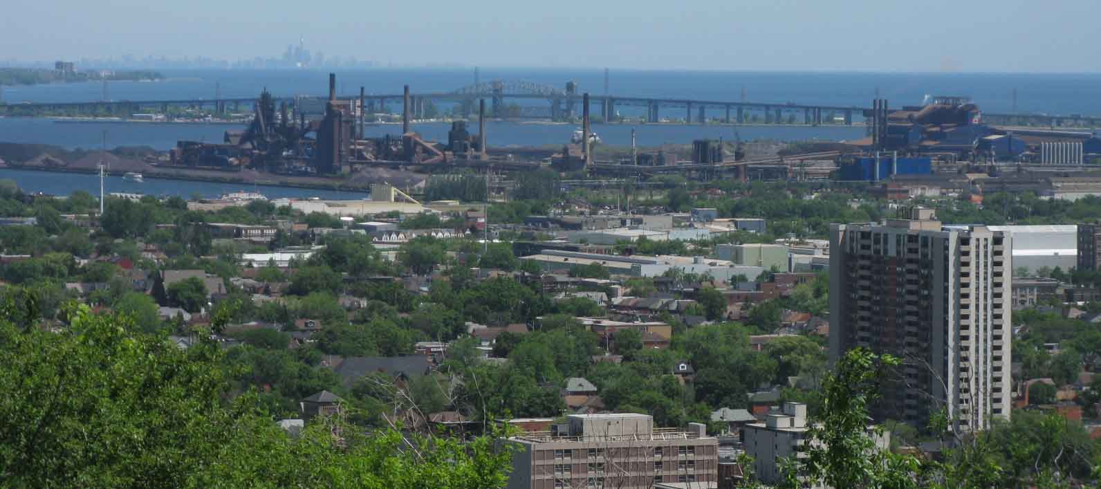
Toronto’s downtown skyline (top left, on the horizon) seen from the Niagara escarpment ln Hamilton at the western end of Lake Ontario and the western limit of Toronto’s current metropolitan area.
3. Shaping the Old City describes the growth of the industrial and streetcar city from the mid-19th century up to 1940. Much of what was created in the course of those hundred years remains and is earnestly celebrated by its denizens for its transit-oriented densities and vibrant streets.
4. The Ascendancy of Metropolitan Toronto examines the role of the innovative but utilitarian regional government of Metro that flourished from about 1950 to 1970, a period of automobile-oriented suburban growth.
5. A Post-Suburban Skyscraper City. Remarkable changes in what is now the City of Toronto, and was previously Metro Toronto, have occurred in last forty years, not least because it is now surrounded by other regional municipalities and can no longer grow outward – it is literally “post-suburban” – and is growing by intensification, building upwards and focussing on suburban downtowns.
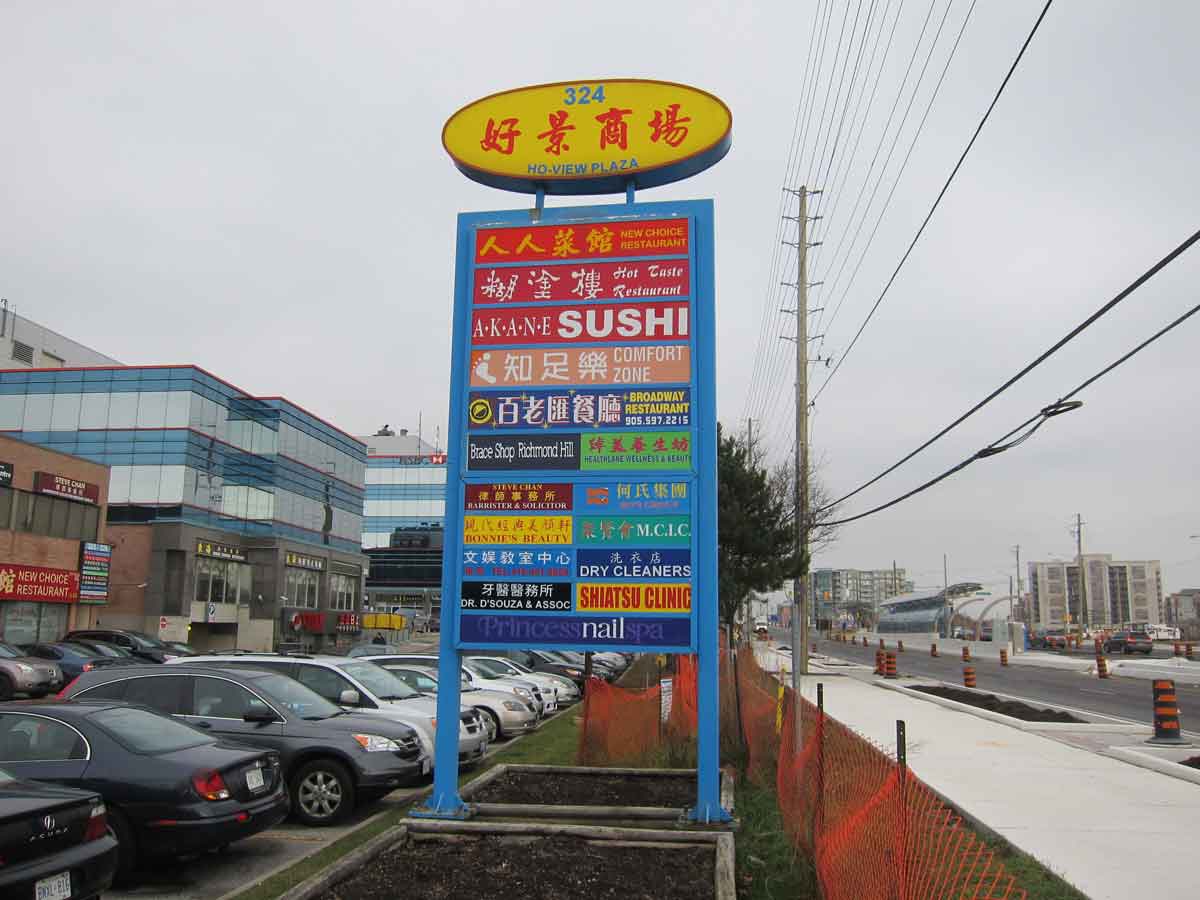
A Chinese plaza on Highway 7 in Markham. The structure with the rounded roof in the centre right is a stop for a bus rapid-transit lane, under construction in 2012 when this photo was taken.
6. Diversity in the Outer Suburbs. The outer suburbs, the areas that surround the City of Toronto, have been rapidly urbanizing since 1970 and now have the majority of the population in the region. In my book I have a single chapter that offers a comprehensive description of their varied landscapes and characteristics. Because little has been written about these new landscapes, in this website I devote two entries to the outer suburbs. The first deals with background characteristics (or matrix) and patterns of land use, and also provides a critical discussion of the idea of sprawl. The second consider the different aspects and diversity of their urban forms – types of centres and corridors, the edge of the built-up area and the exurbs.
7. Polycentricity. Since 1970 Toronto has shifted from a monocentric to a polycentric urban form. This chapter examines the types of multiple centres of the region and the different networks, such as fibre optic cable and data hotels, expressways and fast food franchises, that connect them.
8. Globally Connected, Locally Divided considers Toronto’s economic role as the primary city in Canada and in a network of world cities, its cultural diversity (over half the population is foreign born, and almost half consists of visible minorities), and evidence that social inequalities are intensifying.
9. Containing Growth. Since 2006 three regional plans have been implemented in an attempt to contain the urban expansion of the built-up area of the Toronto region, and to concentrate development around growth centres linked by transit systems. This chapter summarizes these and other planning initiatives.
10. A City for Everybody. Toronto does not have a widely acknowledged identity, personality or even nickname. The concluding entry suggests that its remarkable vitality and sustained growth stem from deep pragmatic attitudes that facilitate accommodation to changes.
Who I Am – A Very Brief Biography
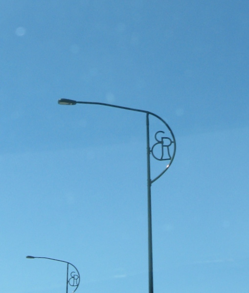
My initials fortuitously displayed on a street light on the Queen Elizabeth Way, opened in 1939 by Queen Elizabeth, the Queen Mother (Elizabeth Regina)
I taught courses on urban landscapes and greater Toronto for many years in Geography and Planning at the University of Toronto, both at its downtown Toronto and Scarborough campuses, and (a long time ago, when it was known as Erindale College) at its Mississauga campus. I have lived in the old City of Toronto, Scarborough and North York. I have written books about sense of place (Place and Placelessness, Pion) and about urban landscapes (The Modern Urban Landscape, Johns Hopkins UP). In 1990 I wrote The Toronto Guide: The City, Metro, the Region, with lots of little sketches and maps, for a conference of the Association of American Geographers held in the city, and this was widely distributed, reprinted and updated several times over the next decade. I have walked, cycled and driven many parts of the metropolitan area to shop, to get things repaired, or simply to explore. I have read books, papers, reports, websites, subway ads and billboards. I have wondered for many years about why the urban forms and landscapes of Toronto and its region look the ways they do. The book and this website are the outcomes of my explorations and wonderings.
I am not using the Comments section of this website. Again, if you have do questions, corrections or comments, please contact me at 1944ecr@gmail.com.